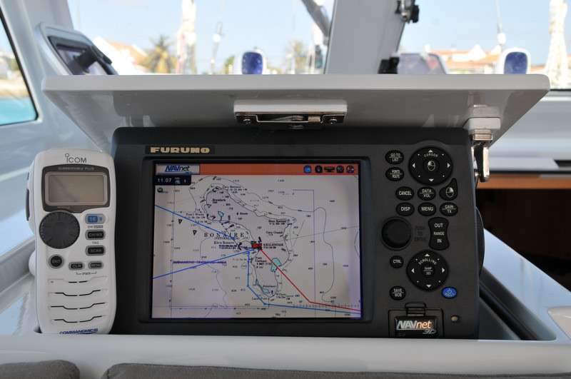
Having only one unit reduced complexity and leaves the helm much more open. Connected to the MFD/8 are:
Furuno DRS4A open array radar
Furuno FA-30 AIS receiver
Furuno GP320 GPS receiver
Furuno PG500 heading sensor
The MFD/8 also picks up the boat instruments which are on the NMEA 2000 network. These include:
Airmar DST800 for depth, speed and water temperature
Furuno FI-501 wind instrument for speed and direction
Furuno FI-50 displays in the cockpit, aft cabin, nav station and forward cabin, and a Maretron DSM250 at the nav station, also display NMEA 2000 network data.
All of the Furuno navigation equipment is tightly integrated with MaxSea Time Zero. The MFD/8 can even use the MaxSea charts which are located on the iMac.
A Furuno GP32 is the primary backup GPS. Before departing on a passage I load all critical waypoints into the GP32 and generally use it at the nav station to monitor our miles completed, miles remaining and ETA. The GP32 is also wired, via NMEA 183, to the iMac so that if the MFD/8 were to fail we can use MaxSea as our primary plotter.
The secondary backup GPS is a Garmin GPSMap 76CSx. It is also loaded with charts and can be our primary electronic navigation if necessary.
Our non-electronic forms of navigation include the paper charts which we carry for each of our planned navigational areas, including both planning charts and harbor charts. And of course the final non-electronic navigational aids are the Suunto F-135K compasses positioned in front of each wheel.